DRONE SURVEYS

The sky’s the limit

Why use a drone survey?
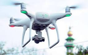
Drones, once a novelty, are now a versatile and invaluable tool for surveying. There are many benefits to using a drone.
Cost-effective
Previously, an aerial survey meant that a cherry picker or scaffolding would need to be hired, set up, the survey conducted and then taken down. Using a drone means not having to hire supplementary equipment which saves money on equipment hire and set up and take-down time.
Time-effective
High quality photographic and video records can be taken in a couple of hours.
Improved health and safety
Using heavy equipment at height increases the risks of falls and other on-site incidents. With a drone survey, no one works at height, eliminating the chance of a fall.
Minimal disruption to property
When surveying with traditional equipment, often access to the site would have to be closed off and operations suspended for the time of the survey. Using a drone minimises disruption to the surveying area.
Surveying inaccessible locations
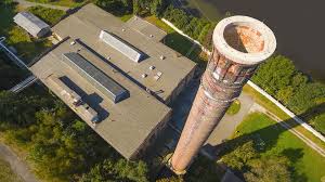
Cumbersome equipment often meant that there were areas they couldn’t effectively survey. A drone can go places that a surveyor or a cherry picker can’t go, such as pitched roofs, quarry edges and waterlogged areas.
Improved data acquisition
A cherry picker and scaffolding made gathering high-resolution images and videos difficult. A drone survey can produce these with ease.
What type of surveys can we carry out with a drone?
- Land and topographic surveys
- Quarry and mineral surveys
- Construction sites
- Infrastructure and property
- Environmental and forestry
Landform Surveys only uses drone pilots that are licensed and certified by the Central Aviation Authority (CAA). This ensures pilots have the proper training and examinations to fly a drone for commercial purposes and accept legal responsibility for their drone.


